

Matthew Bampton
- Department Chair of Geography-Anthropology
- Professor
Bailey Hall room 300f, Gorham campus, AND Wishcamper, room 222, Portland campus
Education
- Ph.D. in Geography, Clark University
- MA in Geography, Clark University
- BA in Geography, Portsmouth Polytechnic, South Hampshire, England
Current Courses
- Physical Geography and Lab
- Geography of Maine
- GIS 1
- GIS 2
- Research Applications in GIS
Research Interests
Matthew’s research focuses on climate impacts on marginal communities in the Arctic and Sub-Arctic. His current project is based in Southern Greenland. He is working with an interdisciplinary group from USM and the University of Maine Climate Change Institute exploring the long-term relationship between people and the environment in and around the Kujataa UNESCO World Heritage Site, Kujalleq. Previously he worked on an interdisciplinary field project in the Shetland Islands combining archeology, geology and GIS to analyze the destruction of a farming community, described here. The core analysis for this work was undertaken in academic year 2014-15 when Matthew was appointed as Fulbright Visiting Professor at the University of Edinburgh in the Institute for the Advanced Study of the Humanities.
His other research interests include GIS education for undergraduates, and developing models for geospatial technology education in a rural region. This work is a collaborative effort, and involves faculty from all seven UMaine System campuses.
For over a decade he worked on a long-term NSF Research Experience for Undergraduates Program with Mark Swanson of USM’s Geosciences program. He has also worked with the Barbara Bush Children’s Hospital, and Maine Medical Center Research on the National Children’s Study: a multi-year study to examine the effects of environmental influences on the health and development of more than 100,000 children across the United States, following them from before birth until age 21. In the past he has studied human impacts on northern New England landscapes during the Colonial period, he has worked with archaeologists from the Thor Heyerdahl museum mapping Moai on Rapa Nui (Easter Island), and he has collaborated with USM Archaeologist to map Native American sites in coastal Maine. Other collaborations include analyzing human rights crises and massacres in Guatemala, seal strandings in the Gulf of Maine, and the geography of obesity.
Matthew Bampton was born and raised in London, England. He came to study in the USA in 1984, and has been teaching at USM since he finished his PhD 1992. He teaches Physical Geography, Geography of Maine, and GIS. He was elected as a Fellow of the Royal Geographical Society in 2023.
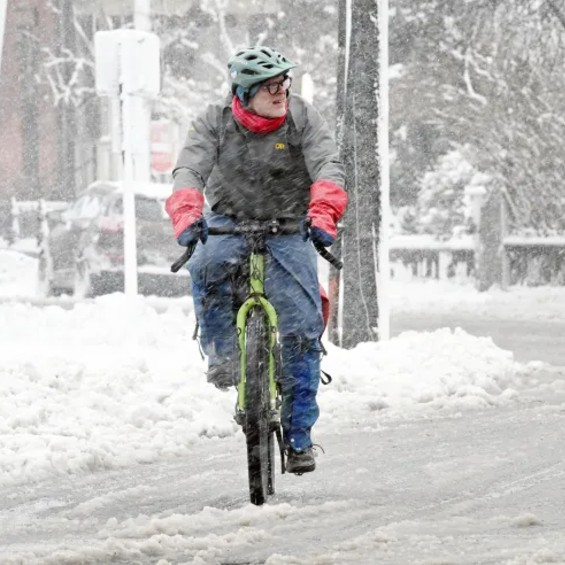
Matthew and his wife have three daughters. He lives in Portland’s West End. He can play the accordion, ride a bicycle, and paddle a kayak. But not all at the same time.
Selected Publications
-
Bampton, M. 2023. The North Atlantic Polar Triangle: Documenting the End of an Epoch. Springer International.
Warren S, Bampton M, Cornick L, Patolo N. 2023. Mapping the Anthropogenic Ocean: A Critical GIS Approach. Geographical Review. Jan 30 1-9.
Michaud, T., Metcalf, C., Gabe, T., & Bampton, M. 2022. Indicators of Flickr Activity as a Proxy for Hospitality Sales: Social Media VGI in Rural Destination Management. International Journal of Gaming, Hospitality and Tourism, 2(1)
Michaud, T., Metcalf, C., & Bampton, M. 2021. Changing Travel and Social Media Patterns in a Destination: Visualizing Impacts and Implications of Covid-19. International Journal of Gaming, Hospitality and Tourism, 1(1)
Michaud, T., Metcalf, C., & Bampton, M. 2021. A Picture is Worth [More Than] a Thousand Words: Visualizing Local and Tourist Perceptions of Greenland through Social Media Photo Mapping Arctic Yearbook 2021
Michaud T, Metcalf C, Bampton M. Exploring COVID-19 Impacts on Maine Tourism Using an Online Photo-Sharing Site. Maine Policy Review. 2021;30(2):56-61
Bampton, M., Kelley, A. and Kelley, J. 2018. The hyperlocal geography of climate change impacts: long term perspectives on storm survivability from the Shetland Islands, Historical Geography. 46:1:129-150
Kelley J. Kelley, Sorrell, L., Bigelow, G. & Bampton, M. 2018. Evidence for a former transgressive dune field: Shetland Islands, United Kingdom. Journal of Coastal Geology. 34:6:1289-1302.
Bampton, M., Kelley J. Kelley, A. Jones, M & Bigelow, G. 2017. Little Ice Age Catastrophic Storms and the Destruction of a Shetland Island Community. Journal of Archaeological Science. 87:17-29
Harris, D. E., Aboueissa, A., Walter, K., & Bampton, M. 2014. Predictors of Food Insecurity in Lewiston, Maine: A Community-Level Analysis. Journal of Hunger & Environmental Nutrition. 9:1:96-112
Harris, D. E., Bampton, M. B., & Aboueissa, A. M. 2013. Two methods that define the scale of obesogenic environments: A case study of Lewiston-Auburn, Maine. Journal of Hunger & Environmental Nutrition, 8:1:11-21
Bampton, M. 2012. Addressing misconceptions, troublesome knowledge and threshold concepts in GIScience education. In Unwin, D., Tate, N. J., Foote, K. E., & DiBiase, D. Teaching Geographic Information Science and Technology in Higher Education. Wiley, NJ.
Bailey Hall room 300f, Gorham campus, AND Wishcamper, room 222, Portland campus
Education
- Ph.D. in Geography, Clark University
- MA in Geography, Clark University
- BA in Geography, Portsmouth Polytechnic, South Hampshire, England
Current Courses
- Physical Geography and Lab
- Geography of Maine
- GIS 1
- GIS 2
- Research Applications in GIS
Research Interests
Matthew’s research focuses on climate impacts on marginal communities in the Arctic and Sub-Arctic. His current project is based in Southern Greenland. He is working with an interdisciplinary group from USM and the University of Maine Climate Change Institute exploring the long-term relationship between people and the environment in and around the Kujataa UNESCO World Heritage Site, Kujalleq. Previously he worked on an interdisciplinary field project in the Shetland Islands combining archeology, geology and GIS to analyze the destruction of a farming community, described here. The core analysis for this work was undertaken in academic year 2014-15 when Matthew was appointed as Fulbright Visiting Professor at the University of Edinburgh in the Institute for the Advanced Study of the Humanities.
His other research interests include GIS education for undergraduates, and developing models for geospatial technology education in a rural region. This work is a collaborative effort, and involves faculty from all seven UMaine System campuses.
For over a decade he worked on a long-term NSF Research Experience for Undergraduates Program with Mark Swanson of USM’s Geosciences program. He has also worked with the Barbara Bush Children’s Hospital, and Maine Medical Center Research on the National Children’s Study: a multi-year study to examine the effects of environmental influences on the health and development of more than 100,000 children across the United States, following them from before birth until age 21. In the past he has studied human impacts on northern New England landscapes during the Colonial period, he has worked with archaeologists from the Thor Heyerdahl museum mapping Moai on Rapa Nui (Easter Island), and he has collaborated with USM Archaeologist to map Native American sites in coastal Maine. Other collaborations include analyzing human rights crises and massacres in Guatemala, seal strandings in the Gulf of Maine, and the geography of obesity.