

Read the Lewiston Sun Journal’s article featuring the Osher Map Library and Smith Center for Cartographic Education’s textile mill exhibition, “Industry, Wealth, and Labor: Mapping New England’s Textile Industry”.
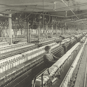
Inspired by the map library’s recent acquisition of a collection of textile mill insurance plans and historic maps from the American Textile History Museum, this exhibition addresses the temporal, geographic, and demographic components of New England’s cotton textile industry from the early 19th century until the middle of the 20th century. The article provides an in-depth background into the historic legacy of the Lewiston Bates Mill and its laborers.
This exhibition was curated by Roberta Ransley-Matteau, MA, Cataloguer for the Osher Map Library and Smith Center for Cartographic Education, and Ron Grim, PhD, Curator of Maps Emeritus at the Norman B. Leventhal Map and Education Center at the Boston Public Library.
“Industry, Wealth, and Labor” is on view now through June 30, 2023. This exhibition is free and open to the public, and all are welcome to stop by or visit oshermaps.org to learn more.