

A University of Southern Maine-led history project is looking at post-Civil War Maine from the perspective of the birds.
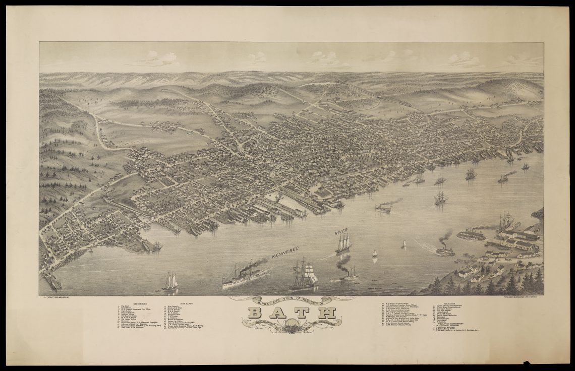
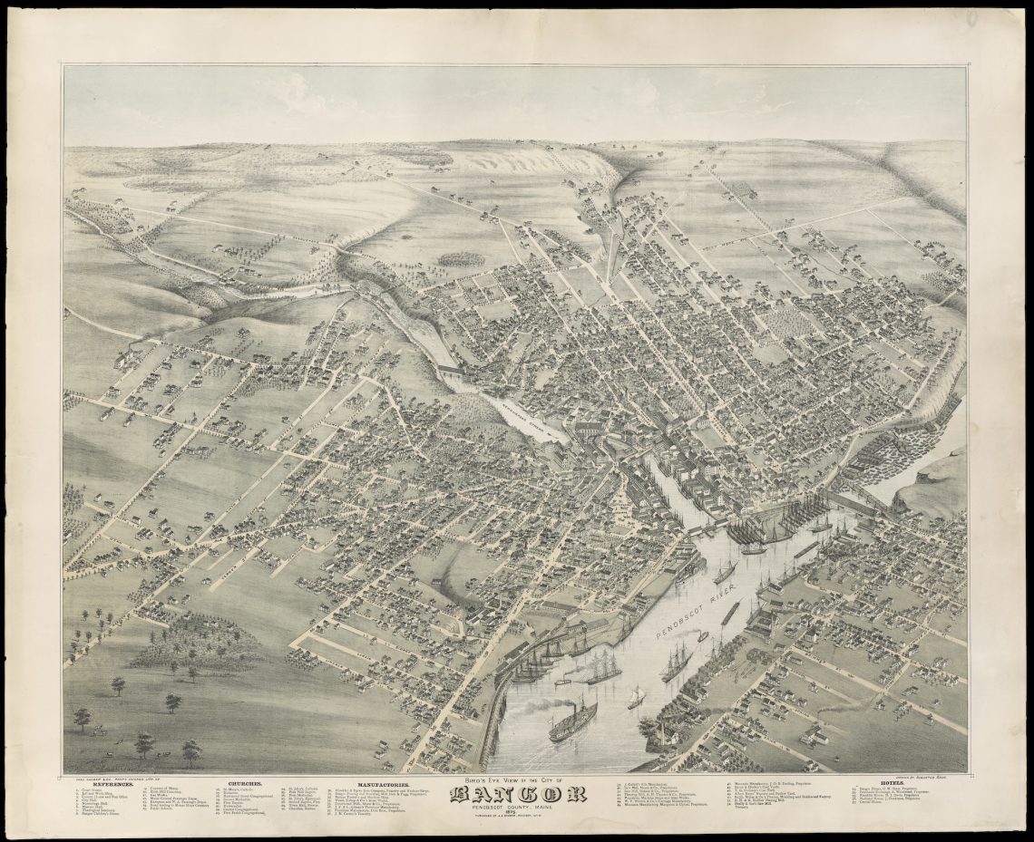
The Osher Map Library & Smith Center for Cartographic Education project — “Maine’s Bird’s Eye Views, 1870-1905” — has gathered 80 aerial renderings of Maine communities published during the era. Each has been digitized and made available to the public online.
The result is one part Google Earth, one part time machine.
From the archive’s map gallery, visitors may choose one of dozens of Maine communities and examine these renderings, made by artists at a time when only balloonists could truly share a bird’s perspective. As much as they could, the artists tried to capture what one might see, including churches, homes, factories, trains and ships powered by sail and steam, said Libby Bischof, a history professor and the Osher Map Library’s executive director.
“Teams of artists would essentially roam the streets of the town, sketching on these long rolls of paper,” Bischof said. “And then they would go back into their studios and they would draw exactly what the buildings were and where they were.”
In their day, the maps became very popular and would often be framed on the walls of living rooms and offices. For historians, or anyone curious about Maine history, they glimpse bustling towns in which factories and train stations were grand and horse-drawn carriages rolled along tree-lined streets.
“I think it’s a marvelous way for these institutions who have this material to share it widely with the public at no cost,” said Earle G. Shettleworth, Maine State Historian and the research lead on the project.
The project was funded by a $7,000 community grant from the Maine Bicentennial Commission. Partners included the Maine Historic Preservation Commission in Augusta, the Maine Historical Society in Portland. The Norman B. Leventhal Map and Education Center at the Boston Public Library and the Library of Congress supplied digitized versions of bird’s eye views not found in the Maine collections.
This site was built by USM Libraries Digital Commons and Digital Projects and Osher Map Library staff members Jessica Hovey and Louis Miller. Maps from OML collections were digitized over the years by David Neikirk and Adinah Barnett, OML’s Digital Imaging team. Maps from Maine Historic Preservation Commission and Maine Historical Society collections were digitized by Adinah Barnett for this project. OML’s summer 2019 intern, USM History major Aidan Haggerty, completed the initial inventory of Maine Bird’s Eye Views. The project was overseen by Bischof.
To Bischof, the maps and their accompanying info — year, population, artist and sometimes newspaper references — glimpses many Maine towns that were centers bustling in the golden age of Maine’s resource economy.
“Many of the smaller towns are so much busier than they are in 2021,” Bischof said. In most cases, newspapers lauded the detailed work of the artists and people bought the maps. “They were incredibly popular for people’s homes and libraries, town and city halls, historical societies and museums.”