


Project leader: Jan Piribeck, Professor, Department of Art (retired)
Envisioning Change visualizes the impact of sea level rise in Portland, Maine and the Casco Bay region over a period of 200 years (1900-2100). Sea level change generally occurs so gradually that it is nearly imperceptible, except when major storm surges hit our coastlines and dramatically alter the landscape and its ecosystems. It is crucial to develop new and imaginative ways of communicating about sea level rise so that individuals and communities will understand its impact on the Maine environment and be prompted to make responsible decisions about how best to respond to the changes.
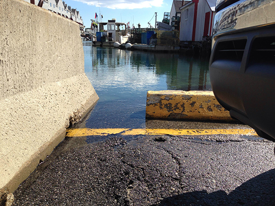
This project is based on the principle that the arts can play a significant role in increasing environmental awareness, and can work with the sciences and technology to make visible something as incremental yet powerful as sea level change. Below is a photograph of Widgery Wharf in Portland, Maine, where rises in seatides are evident at one of the oldest wharfs on the waterfront. Taken by USM design student Abigal Krolak, this photograph was a finalist in the Gulf of Maine King Tides Photo Contest, which was a region-wide competition and online exhibition featuring images of the extreme high tide on October 9, 2014.
Envisioning Change engages artists, designers, community members and students in collecting and processing data, and will use a variety of analytic and expressive tools to chronicle and distribute information about the rising tides. It aims to increase public awareness of and involvement with sea level change as it relates to Portland and Casco Bay, by creating an informational website and digital database; these will serve as a public resource for community members and researchers interested in sea level change, and through the creation of publicly engaged environmental art.
Student involvement in this project is central to its goal of making sea level change a topic of public discussion and community engagement. Recently, several USM students participated in a King Tides observation event in October 2014, and also created 4.1 mile King Tides Trail covering the Bayside and Eastern Promenade trails in Portland.
Funding support for this educational installation came from the Limulus Fund at the Maine Community Foundation through the Gulf of Maine Council on the Marine Environment’s Climate Network, which coordinates the Gulf of Maine King Tides Project. The project was approved by the City of Portland’s Student Art Review Committee and permitted by the City of Portland.
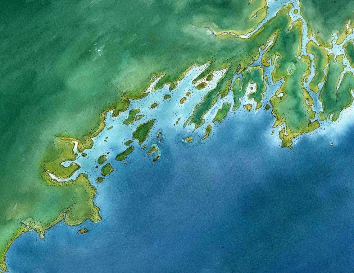
This slide is of a hand-painted map of the Portland peninsula created by Molly Holmberg Brown, PhD, Artist/Owner of MollyMaps, a Portland company that partnered with Envisioning Change to create four unique views of Casco Bay and the Portland peninsula. The maps combine the expressive qualities of traditional watercolor with perspectives influenced by aerial photography. They were designed to be a graphic interface for the Envisioning Change website and to provide a substrate upon which layers of information about tidal flooding can be layered. Viewers familiar with the peninsula will recognize some of the landmarks symbolized by deep red roofs on the map; these are Whole Foods, U-Haul, B & M Baked Bean Plant, Ocean Gateway Terminal – MoonTide Garden, Widgery Wharf and the Gulf of Maine Research Institute. These locations are all significant in regards to the observation and study of sea level change.