Skip to content
News

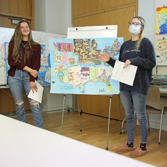
Social Work students convey complex ideas through mapmaking

Each of the four maps produced by Dr. Paula Gerstenblatt’s Social Work class used different techniques including collage and allegory to illustrate how student loan debt grew into a national problem.

Read More

OML offers bird’s eye look at post-Civil War Maine

The Osher Map Library & Smith Center for Cartographic Education project — “Maine’s Bird’s Eye Views, 1870-1905” — has gathered 80 aerial renderings of Maine communities published during the era. Each has been digitized and made available to the public online.

Read More